Theoretical Map Survey - Project Overview
2010 – photographic installation
ten 22”x28” c-prints and mixed media tape objects, flat file, tables, computer, printer, & examination tools
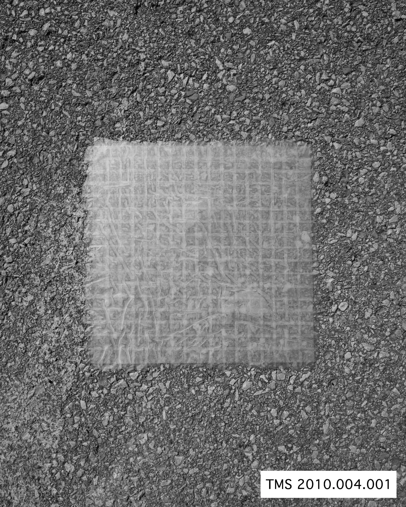
TMS 2010.004.001
Site photograph
“A matter of moving in place, getting intensely involved just there, in a space of the smallest deviation”
—Edward S. Casey, Earth-Mapping
The Theoretical Map Survey project is a piece consisting of two components, a performative action, and an installation containing the remains of the action. It is about defining significant evidences of spatial exploration in a space through a process. The process used creates delineations, or maps, of that space. These function not as symbolic representations of the territory explored, removed and isolated, but are composed of materials within and existing throughout the territory. It is hoped that an understanding will form that is intrinsically linked to the physical materiality of the space, yet reveals otherwise imperceptible qualities existing only to that space. Secondly, the piece also explores the afterlife of such delineations or objects as they become curated and entrenched into the language of the museum object and are processed for visual consumption and reproduction by the viewer.
The territory the piece concerns itself with has been continually explored by myself, during my explorations I contained areas found within in the space under transparent tape, creating containers for any loose materials from the surface. The containers were photographed as existing in situ, with the photograph acting as a document of the container having existed in that space during that time. Collected as mapped, site-sampled databases containing traces of the territory, the containers were further photographed and preserved within the installation components of the piece.
The installations functions as collections of information using a museum dialogue, where the site-sampled containers are processed in three forms as a means of affecting understanding between my experience within the territory and the viewer’s encounter with the delineated traces of the territory. These forms are in the large installation as the in situ photographs, displayed in a way as to mimic the creation of the maps, the physical tape maps in a flat file cabinet, and a computer database containing images of the maps as museum objects, labeled and categorized. They are re-presented in the smaller installation as another museum source might present these objects to their audience.
By encountering the maps both as art objects and as curated museum objects, the viewer is encouraged to bridge the gap that exists between the two forms of visual communication about objects.